
Click or scroll to zoom
Tap or pinch to zoom
C-MAP MAX Lakes NA-M018 - Region 2: East - C-Card
by C-Map
Call for Availabity!
$129.00
$128.99
SKU 30546
Manufacturer Part Number: NA-M018C-CARD
UPC #: 0
Category: C-Map MAX Lakes
Manufacturer Part Number: NA-M018C-CARD
UPC #: 0
Category: C-Map MAX Lakes
Designed for freshwater fishing and hunting, MAX Lakes delivers the highest level of detail and value-added data not found on any other electronic charts on the market. Also, the MAX Lakes database is constantly growing and is updated yearly!
Features:
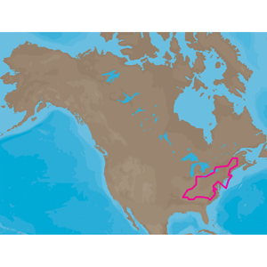
NA-M018 => MAXLakes East
Includes coverage for 900+ lakes in Maine, New Hampshire, Vermont, Massachusetts, Rhode Island, New York, Connecticut, Pennsylvania, Maryland, New Jersey, Delaware, Ohio, Virginia, West Virginia, Kentucky, Tennessee and North Carolina. River coverage includes the Hudson River and Erie Barge Canal (to Lyons, NY) as well as all of the Ohio River from Cairo, IL (MM 981) to Pittsburgh, PA (MM 0), the Tennessee River from Paducah, KY (MM 0) to Knoxville, TN (MM 652), the Cumberland River from Smithland, KY (MM 0) to the Kentucky/Tennessee border (MM 389), as well as the Green River in Kentucky, the Kanawha River in West Virginia and the Allegheny and Monongahela Rivers in Pennsylvania. Partial coverage of the Lower Mississippi River from Memphis, TN (MM 711) to Cairo, IL (MM 953) is also included.
Features:
- Shaded Depth Areas
- Points of Interest (POIs) such as campgrounds, shops, gas stations & more
- State Fishing Regulations
- State Hunting Regulations
- Fish Identification Photos
- Water Fowl Identification Photos
- Interstate Highways, Secondary and Lake Roads
- Boat Ramps
- National Parks and Recreation Areas
NA-M018 => MAXLakes East
Includes coverage for 900+ lakes in Maine, New Hampshire, Vermont, Massachusetts, Rhode Island, New York, Connecticut, Pennsylvania, Maryland, New Jersey, Delaware, Ohio, Virginia, West Virginia, Kentucky, Tennessee and North Carolina. River coverage includes the Hudson River and Erie Barge Canal (to Lyons, NY) as well as all of the Ohio River from Cairo, IL (MM 981) to Pittsburgh, PA (MM 0), the Tennessee River from Paducah, KY (MM 0) to Knoxville, TN (MM 652), the Cumberland River from Smithland, KY (MM 0) to the Kentucky/Tennessee border (MM 389), as well as the Green River in Kentucky, the Kanawha River in West Virginia and the Allegheny and Monongahela Rivers in Pennsylvania. Partial coverage of the Lower Mississippi River from Memphis, TN (MM 711) to Cairo, IL (MM 953) is also included.
![C-MAP MAX NA-M320 -Passamaquoddy Bay ME-NC: Bathy - C-Card [NA-M320C-CARD]](http://cemarine.com/cdn/shop/files/33236XL_512x512.jpg?v=1731455787)
![Navionics Platinum+ NPUS013R - Canada, West Alaska [010-C1467-40]](http://cemarine.com/cdn/shop/files/102656XL_512x512.jpg?v=1708636877)
![Navionics Platinum+ NPUS012R - Canada, East Great Lakes [010-C1466-40]](http://cemarine.com/cdn/shop/files/102655XL_512x512.jpg?v=1708636871)
![Navionics NAUS013R - Canada, West Alaska - Navionics+ [010-C1467-30]](http://cemarine.com/cdn/shop/files/102654XL_512x512.jpg?v=1708636864)
![Navionics NAUS012R - Canada, East Great Lakes - Navionics+ [010-C1466-30]](http://cemarine.com/cdn/shop/files/102653XL_512x512.jpg?v=1708636857)