![C-MAP 4D NA-D951 Cabo San Lucas, MX to San Diego, CA [NA-D951]](http://cemarine.com/cdn/shop/products/50320XL_512x512.jpg?v=1642746289) Call for Availabity!
Call for Availabity!
C-MAP 4D NA-D951 Cabo San Lucas, MX to San Diego, CA [NA-D951]
C-MAP
C-Map 4D NA-D951 Cabo San Lucas, MX to San Diego, CAThe next evolution in navigation solutions. C-MAP 4D adapts to your boating needs because it's...
View full details
![C-MAP 4D NA-D964 - Puerto Rico to Rio Orinoco Local [NA-D964]](http://cemarine.com/cdn/shop/products/60786XL_512x512.jpg?v=1642746965)
![C-MAP 4D NA-D965 - Cuba, Dominican Republic, Caymans & Jamaica [NA-D965]](http://cemarine.com/cdn/shop/products/60787XL_512x512.jpg?v=1642746972)
![C-MAP 4D NA-D966 - Belize to Panama Local [NA-D966]](http://cemarine.com/cdn/shop/products/60789XL_512x512.jpg?v=1642746980)
![C-MAP 4D NA-D967 - Panama to Guatemala Local [NA-D967]](http://cemarine.com/cdn/shop/products/60790XL_512x512.jpg?v=1642746987)
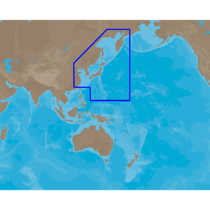
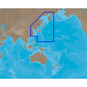
![C-MAP 4D PC-D203 Carolinas, Kiribati, Marshall Marianas [M-PC-D203-MS]](http://cemarine.com/cdn/shop/products/79105XL_512x512.jpg?v=1678216622)
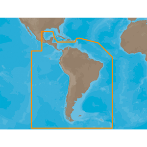
![C-MAP 4D SA-D500 Costa Rica to Chile to Falklands [SA-D500]](http://cemarine.com/cdn/shop/products/71429XL_512x512.jpg?v=1642748089)
![C-MAP 4D SA-D501 Gulf of Paria to Cape Horn [SA-D501]](http://cemarine.com/cdn/shop/products/80867XL_512x512.jpg?v=1642749745)
![C-MAP 4D SA-D905 Recife to Rio De Janiero [SA-D905]](http://cemarine.com/cdn/shop/products/64778XL_512x512.jpg?v=1642747237)
![C-MAP M-NA-Y200-MS DISCOVER North America [M-NA-Y200-MS]](http://cemarine.com/cdn/shop/products/87522XL_512x512.jpg?v=1642751152)
![C-MAP M-NA-Y201-MS Great Lakes To Nova Scotia REVEAL Coastal Chart [M-NA-Y201-MS]](http://cemarine.com/cdn/shop/products/87524XL_512x512.jpg?v=1642190307)
![C-MAP M-NA-Y202-MS Nova Scotia to Chesapeake Bay REVEAL Coastal Chart [M-NA-Y202-MS]](http://cemarine.com/cdn/shop/products/87526XL_512x512.jpg?v=1642190314)
![C-MAP M-NA-Y203-MS Chesapeake Bay to Bahamas REVEAL Coastal Chart [M-NA-Y203-MS]](http://cemarine.com/cdn/shop/products/87527XL_512x512.jpg?v=1642190322)
![C-MAP M-NA-Y204-MS Gulf of Mexico to Bahamas REVEAL Coastal Chart [M-NA-Y204-MS]](http://cemarine.com/cdn/shop/products/87528XL_512x512.jpg?v=1642751174)
![C-MAP M-NA-Y205-MS Central America Caribbean REVEAL Coastal Chart [M-NA-Y205-MS]](http://cemarine.com/cdn/shop/products/87529XL_512x512.jpg?v=1642751182)
![C-MAP M-NA-Y206-MS West Coast Baja California REVEAL Coastal Chart - Does NOT contain Hawaii [M-NA-Y206-MS]](http://cemarine.com/cdn/shop/products/87530XL_512x512.jpg?v=1642751189)
![C-MAP M-NA-Y207-MS Columbia Puget Sound REVEAL Coastal Chart [M-NA-Y207-MS]](http://cemarine.com/cdn/shop/products/87531XL_512x512.jpg?v=1642190330)
![C-MAP M-NA-Y208-MS Alaska REVEAL Coastal Chart [M-NA-Y208-MS]](http://cemarine.com/cdn/shop/products/87532XL_512x512.jpg?v=1642190339)
![C-MAP M-NA-Y209-MS Canada North East REVEAL Coastal Chart [M-NA-Y209-MS]](http://cemarine.com/cdn/shop/products/87533XL_512x512.jpg?v=1642190347)
![C-MAP M-NA-Y210-MS Hawaii Marshall Islands French Polynesia REVEAL Coastal Chart [M-NA-Y210-MS]](http://cemarine.com/cdn/shop/products/87545XL_512x512.jpg?v=1642751210)
![C-MAP M-NA-Y211-MS US Lakes West REVEAL Inland Chart [M-NA-Y211-MS]](http://cemarine.com/cdn/shop/products/87546XL_512x512.jpg?v=1642190354)
![C-MAP M-NA-Y212-MS US Lakes North Central REVEAL Inland Chart [M-NA-Y212-MS]](http://cemarine.com/cdn/shop/products/87547XL_512x512.jpg?v=1642190363)
![C-MAP M-NA-Y213-MS US Lakes East REVEAL Inland Chart [M-NA-Y213-MS]](http://cemarine.com/cdn/shop/products/87548XL_512x512.jpg?v=1642190372)
![C-MAP M-NA-Y214-MS US Lakes South East REVEAL Inland Chart [M-NA-Y214-MS]](http://cemarine.com/cdn/shop/products/87979XL_512x512.jpg?v=1642190396)
![C-MAP M-NA-Y215-MS US Lakes South Central REVEAL Inland Chart [M-NA-Y215-MS]](http://cemarine.com/cdn/shop/products/87549XL_512x512.jpg?v=1642190380)
![C-MAP M-NA-Y216-MS Canada Lakes REVEAL Inland Chart [M-NA-Y216-MS]](http://cemarine.com/cdn/shop/products/87550XL_512x512.jpg?v=1642190388)
![C-MAP M-SA-Y038-MS Discover South America Caribbean [M-SA-Y038-MS]](http://cemarine.com/cdn/shop/products/79656XL_512x512.jpg?v=1642749474)
